A Global Positioning System – GPS for Short – is simply a method by which one can determine one’s precise (emphasis on precise) position on the earth. Once upon a time, that task was not only difficult, but it was also darn near impossible. Our ancestors built giant landmarks, laboriously drafted “detailed” maps and learned how to read the sun and stars in order to find their way. Finding your way wasn’t always so easy.
Warning: Geek Alert!! This article may contain information that some may find technical and boring.
(This page may contain affiliate links, which means I may earn a small commission if you click through and make a purchase. You can read our Affiliate Disclosure here.)
However, in order to really know where one is, one absolutely must know two very important pieces of information in order to know position: 1) the date and 2) the accurate time (emphasis on accurate). Now that may seem a bit silly – everyone knows what day it is and what time it is – everyone has a calendar and either a watch or cell phone. And, if you have access to a signal, the cell phone gives us both date and time! But it wasn’t so very long ago that not only did we not have cell phones, but our timekeeping devices were also woefully inaccurate.
And our calendars? They have never been accurate – at least not to any great extent. If you are unsure about why, simply ask yourself about the use of Leap Years, which by itself is an additional and lengthy subject for another time.
Finding Your Way – Approximately…
So, what is the big deal? Well, without getting very deeply into what most would find to be a boring Physics and History lesson, suffice it to say that if one knows what day it is – relative to a known date such as a Solstice or Equinox – one can use a little basic Mathematics and Trigonometry to determine one’s approximate latitude (distance north or south of the Equator).
And if one also then knows the correct time – at least relative to a standard, say at Greenwich, England – one can again use a bit of basic Mathematics to determine one’s approximate longitude. There is obviously a good deal of information that I have left out. But knowing the latitude and longitude will reveal one’s approximate location.
As an interesting exercise, try to imagine yourself as the first mate on Christopher Columbus’s ship. While in the middle of the ocean and using only a crude device known as a sextant and without a timekeeping device of any sort, how easy do you think it would be to determine where you were, let alone how to get back home! Easy? Not! Think about it for a second, and as you might suspect, we take a vast amount for granted in today’s world, especially when it comes to finding our way from point A to point B. No wonder Chris missed his mark!
How it Works – The Process
Fast forward to 1994 when the last in a series of 24 GPS satellites was placed into orbit, 20 years after the first in 1974. (There are currently 32 satellites, with 24 remaining operational around the clock.) The U.S. military originally developed and implemented the network but later opened it up to the public. This forever changed navigation.
We actually now have numerous extra orbiting satellites, just in case of failures. Each of the 24 is “parked” at a distance of about 12,000 miles above the surface of the earth and completes an orbit of the planet twice per day. The satellites are configured such that at least four of these satellites are “visible” to your GPS receiver at any given time.
A GPS receiver needs four satellites to work out its position in three dimensions. We’ll skip the details – they get a bit involved – but stated simply, highly accurate time and distance measurement is still necessary in order to locate ourselves on the surface of the earth.
The process is referred to as 3-D Trilateration and necessitates our GPS receiver being able to determine precisely (well, almost) how far it is from at least three (preferably 4) of the satellites by analyzing high-frequency, low-power radio signals from the GPS satellites. These signals, by the way, are traveling at the speed of light; analysis must be done rapidly.
Signals Received and Interpreted
The receiver also has to know where the satellites – which are constantly moving – are. This is determined by the GPS receiver using and analyzing a stored journal which indicates where the satellites are supposed to be. Here is where the water gets a bit muddy, since nothing is ever exactly how it is supposed to be, and the error sources are many and complex. So, we’ll skip the rest of the technical stuff.
The interesting and useful information is a result of what happens with the signals that are received and interpreted by your GPS receiver. In addition to latitude and longitude, your receiver, depending on its cost and sophistication, can tell you things like your elevation, times of sunrise and sunset, how far and how long you have traveled and at what speed. A GPS receiver can create a path for you to retrace so you can find your way back home. It can also interface with computers and can use downloaded maps to give you even more detailed information about your location. And it can store information so that you can easily find your way back to a specifically marked location in the future.
Early GPS Units
Early GPS units were large, cumbersome, expensive, and not very accurate. Today’s units are often quite tiny by comparison and accurate to within 15 feet and often less, depending on models. Future receivers will attain accuracy to within a few millimeters. Remember, nothing is ever perfect… Most importantly for us, as technology has improved accuracy, cost has plummeted, and use has broadened.
Not only is GPS a household word, it also has become a household product. What began as a project available only to the hands of the military is now available to the hands of everyone. It’s avai;lable at a price that almost anyone can afford. Some very decent receivers can be had for less than $100, although some can cost upwards of $1000. Yes, we can accurately guide cruise missiles to the bunkers of enemy soldiers, but we can also safely guide commercial airplanes to runways with virtually zero visibility.
And we can guide every fisherman back to that secret spot he stumbled across by accident, or rescuers to stranded hikers. We can track your UPS packages or locate your stolen car. We can locate a zillion points and create an accurate map from them. Heck, we even have available the turn-by-turn voice-activated guidance systems that should benefit all of us who never again want to ask directions!
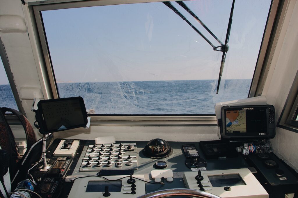
The GPS receiver is truly a marvel of modern science and, like most of the other devices that have made our lives easier, we generally have no idea exactly how it works. But who really wants to know? Most important is that it does work. I carry one with me in my boat at all times, ‘cause I know that when I’m out on the lake, there aren’t too many people from whom to ask directions back to my cabin! And just think how interesting a world it would be if Christopher Columbus would have instead been able to navigate to North America…
See you On the Lake!
R. Karl


